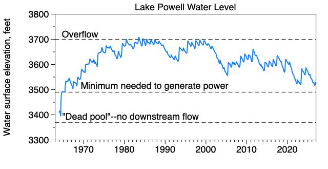
Level of Lake Powell since its filling
DISCLAIMER: I am not a hydrologist and realize that my analysis below is crude. But hey, it’s interesting.
I am going on a river trip in the Grand Canyon at the end of May, and have been wondering about what the flow in the Colorado River might be and whether Lake Powell will have dropped below the power-generation level by then (see above). The super-strong El Niño brewing up will probably affect this, and so I’ve been watching discharge in the Green, Colorado, and other rivers that flow into the Colorado above and below Lake Powell.
Checking all those gaging stations got a little tedious, so I put them all on one webpage that I’ve been tweaking. Here is one of four panels in the output:
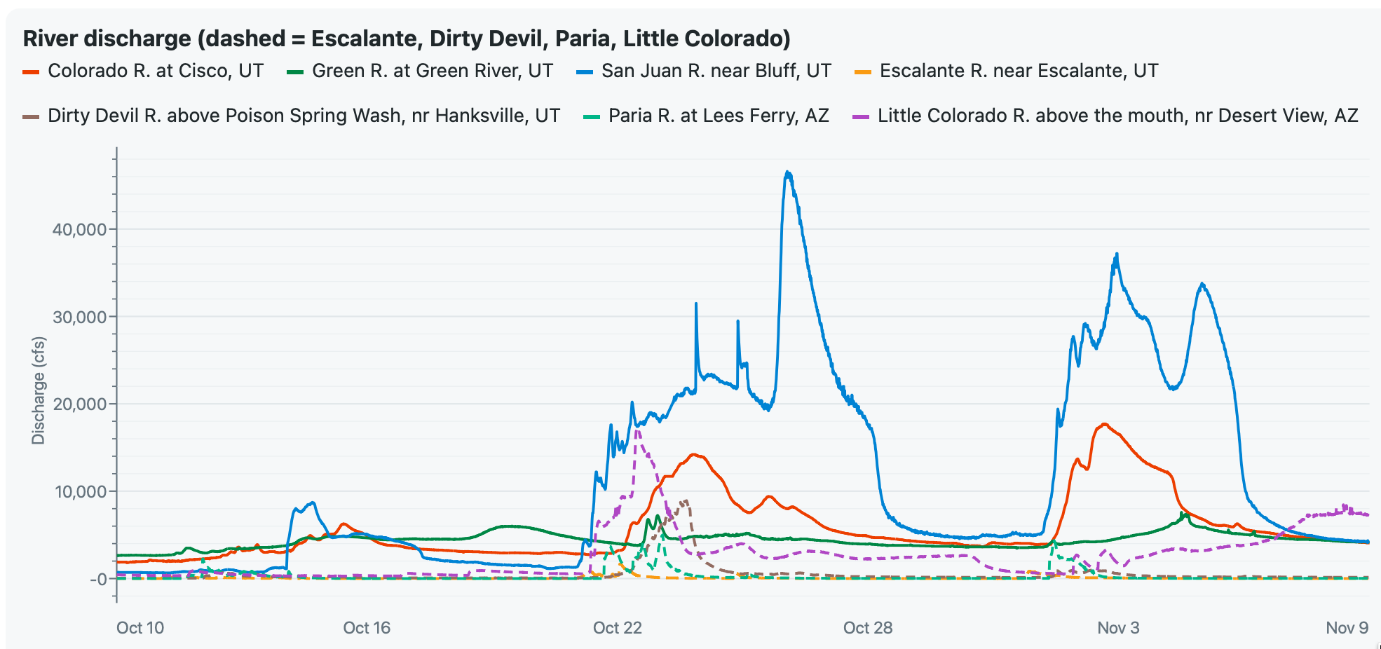
Discharge of Colorado, Green, San Juan, and other rivers on the Colorado Plateau
Other panels show total discharge for all the rivers feeding Lake Powell, the elevation of Lake Powell, and an estimate of flow in the canyon (Lake Powell discharge plus the Little Colorado and Paria Rivers).
Severe storms on the Plateau in late October and early November 2026 have really tweaked the system. The plot above shows that the San Juan River, which caused extensive flooding in Bluff and several communities upstream, hit 46,000 cfs in October and was over 30,000 cfs twice in early November. Estimated flow in the canyon in October peaked at 27,000 cfs, three times the normal release from Glen Canyon Dam. Torrential rain in early November led to the Little Colorado River rising to over 5,000 cfs by 7 Nov 2026, nearly doubling flow in the canyon below Marble Canyon.
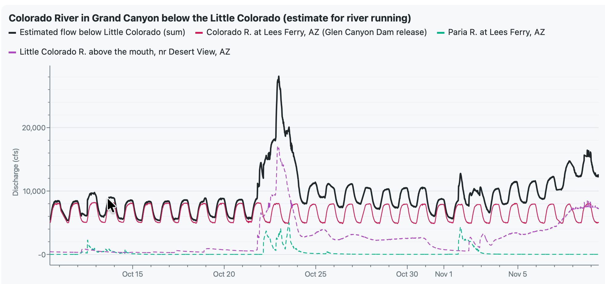
Estimated discharge of the Colorado River in the Grand Canyon below Marble Canyon
One benefit of these storms is that they raised the level of Lake Powell by 22 feet (so far). The lake is currently (as of 9 Nov) about 6.5 feet below where it was a year ago.
Stay tuned—it will be interesting to watch the river system evolve during this El Niño winter.