Death Valley Flooding 2022: The Futile Diversion Attempt at Gower Gulch
August 7, 2022
Furnace Creek Wash drains a big area—440 square kilometers, an area about equal to that of Lake Tahoe. The wash is dry most of the time, but cloudburst storms can change that in a hurry and chew up buildings, roads, and other infrastructure at the mouth of the canyon, where Furnace Creek Inn sits.

Service station in the wash at the mouth of Furnace Creek, 1935. Not a good place to put gas pumps and storage tanks. Photo from the Los Angeles Times.
Eighty or so years ago a mining company decided to fix the problem by erecting a berm across the wash and diverting stream flow into the head of Gower Gulch, which at that time drained an area about 100 times smaller.
It is doubtful that the mining company obtained any permits for this work. This was back when you could drive up Natural Bridge Canyon and to the Zabriskie Point viewpoint, and when the Park Service would routinely dynamite the salt crust at Devil’s Golf Course to keep the salt pools open for tourist view.

The berm is visible in a 1948 U.S. Geological Survey aerial photograph. Here’s the full frame:
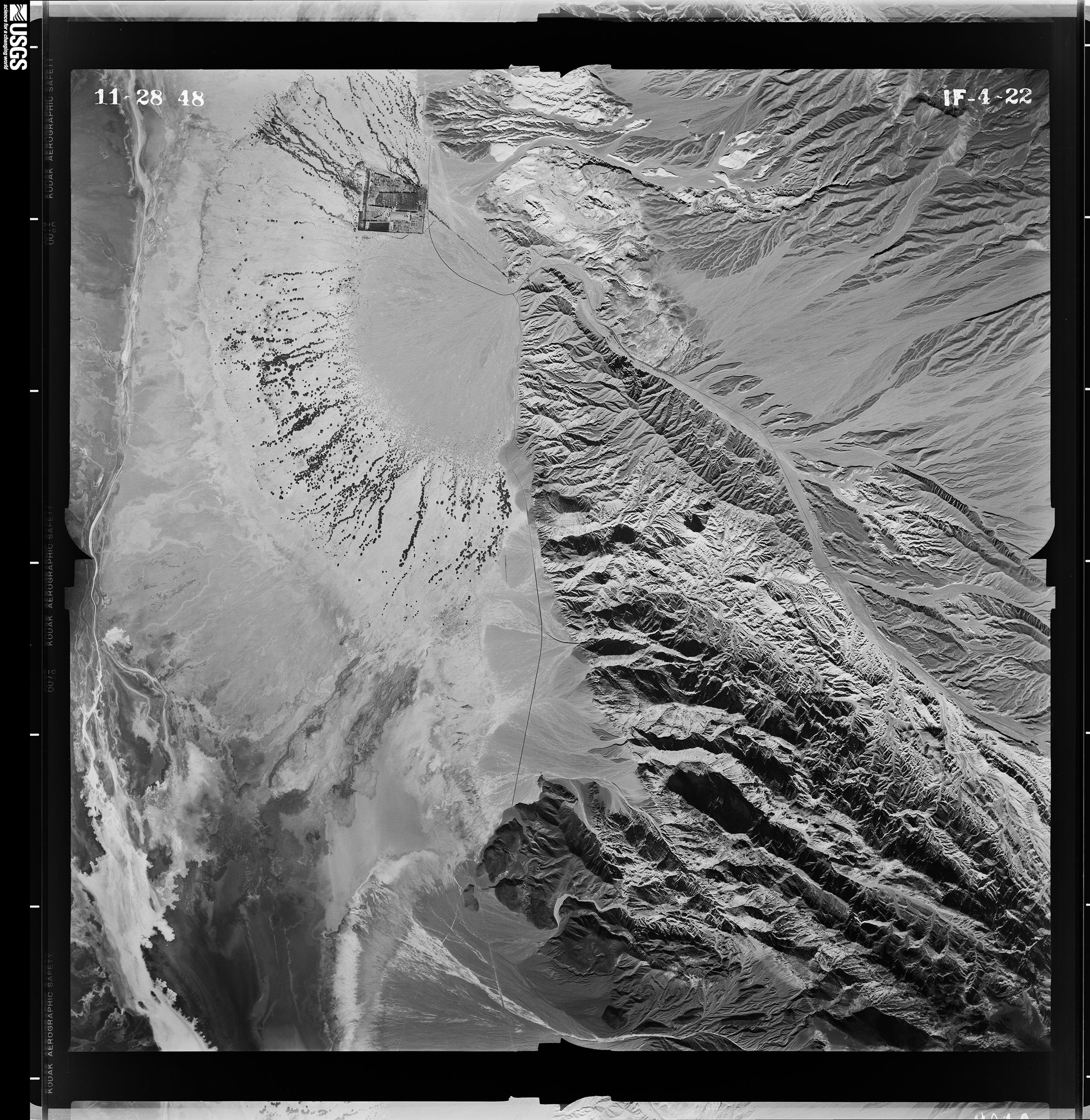
1948 aerial photo of Furnace Creek Wash. The main wash comes in from the lower right (southeast), heads northwest, makes a hard left turn, and then debouches (a good geology word) onto the beautiful cone of the Furnace Creek alluvial fan. The square block of development on the north side of the fan is Furnace Creek Ranch. Furnace Creek Inn is at the head of the fan, too small to resolve at this scale.
Here is a closeup of the Zabriskie Point area, where the bulldozed berm is easy to see 7 or 8 years after it was built:
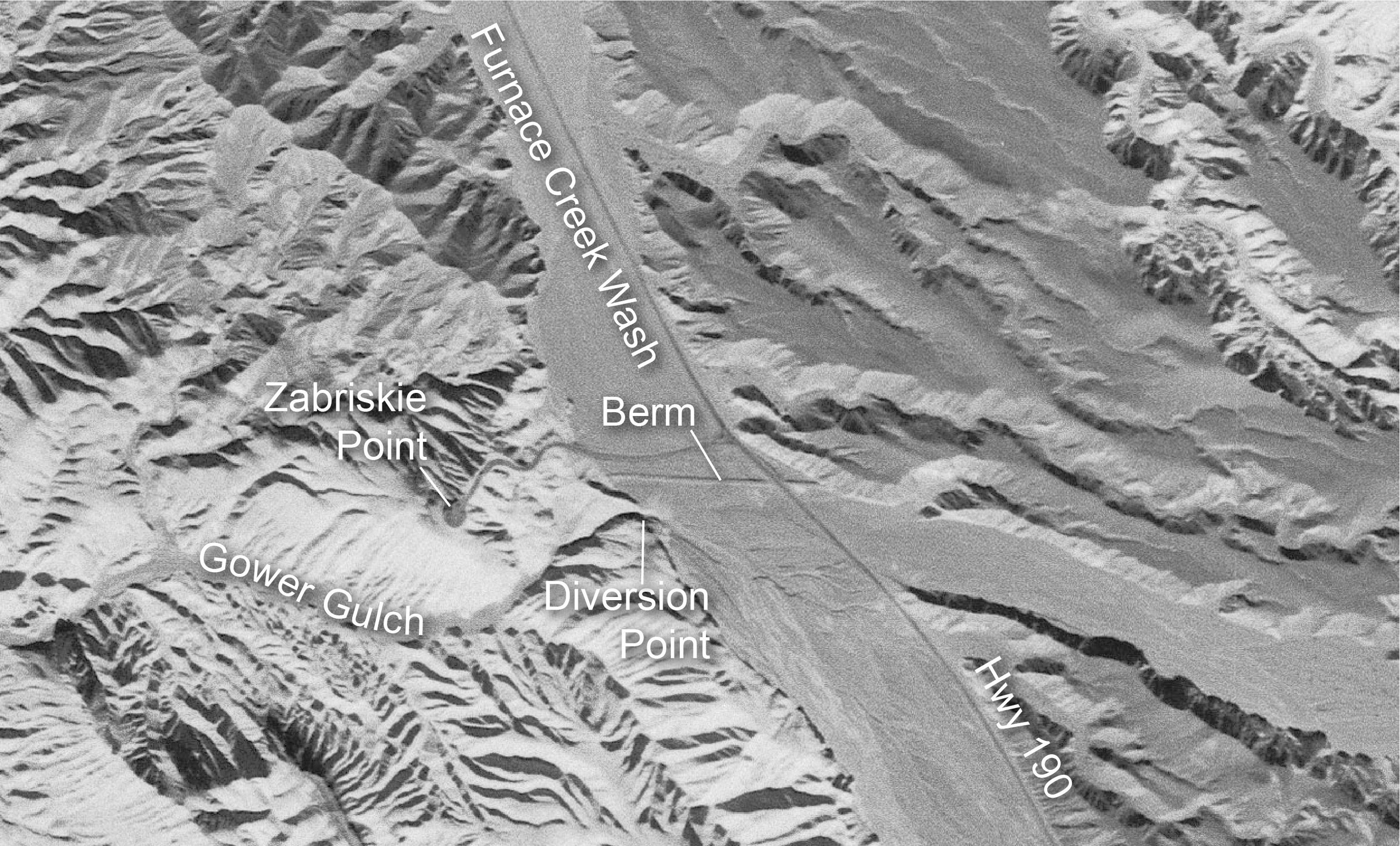
The berm was just south of the road up to Zabriskie Point. There is no trace of it left now owing to road grading and flooding. The current parking area (which may have been ripped up in this month’s floods) covers most of where it was. Note the small streams that had already formed across Furnace Creek Wash just south of the berm, heading for the newly blasted cut into Gower Gulch.
In 2005 NCALM flew a LIDAR survey of this area under a grant obtained by Noah Snyder of Boston College. Here is the same area. Note how much more erosion there has been at and upstream (southeast) of the diversion point.

Lidar image of the Gower Gulch area. Note how much entrenchment there has been and how the gulch is eating eastward and into the highway, aided by floods coming down the large unnamed side wash that enters from the right (east). Data source: Furnace Creek Wash, Death Valley National Park, California. Distributed by OpenTopography. https://doi.org/10.5069/G9P848VX . Accessed: 2022-08-07
The view east from up by the Zabriskie Point overlook is interesting. Here are two: one shot in 1973 by Bob Norris, and the other in 2017. The deep shadowed cleft at right is uppermost Gower Gulch, where floods send some—but not all—of their water.
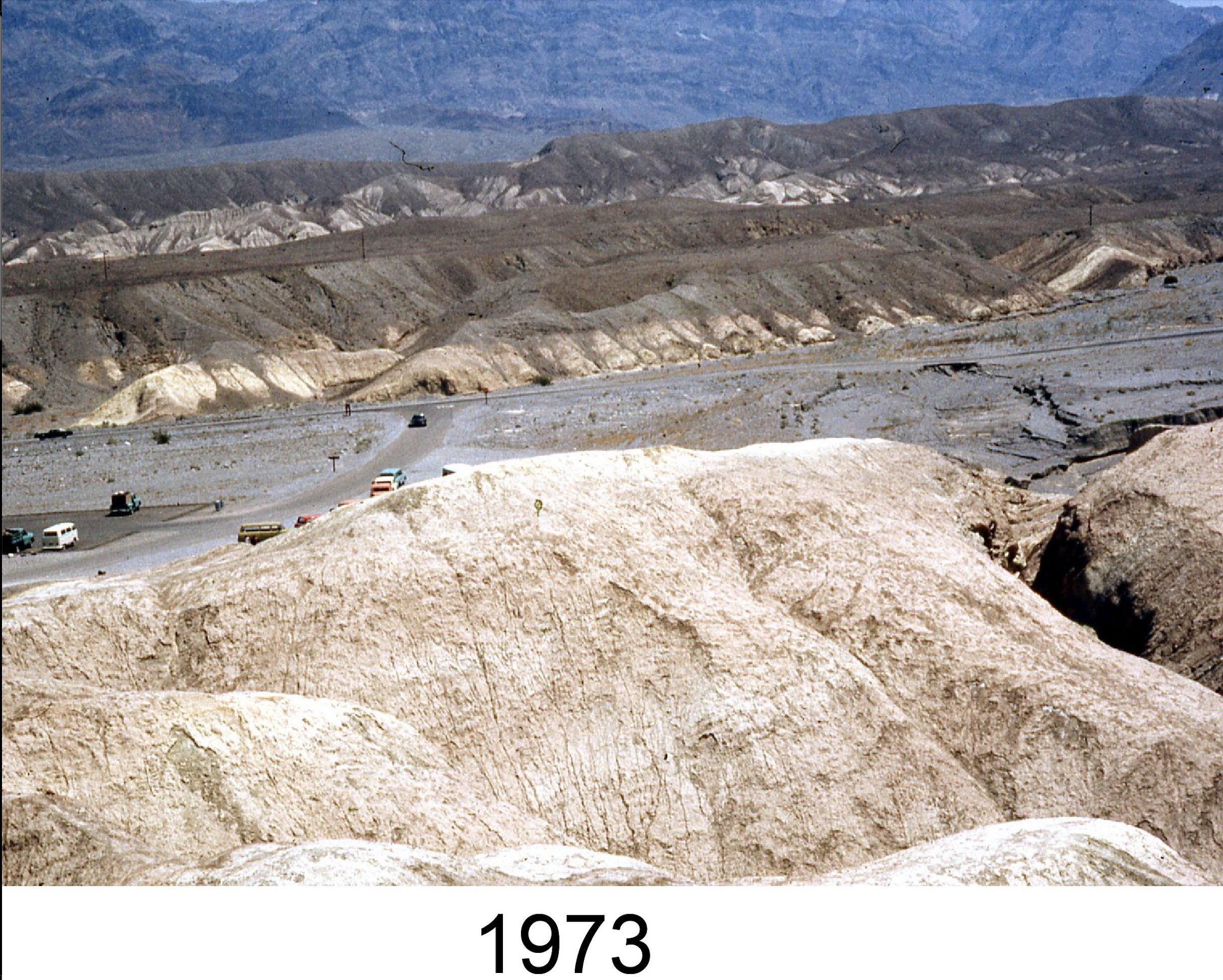
Looking east from Zabriskie Point toward Highway 190 in 1973. Headward erosion of Gower Gulch has started to eat into the highway, which is built in the wash.

The same view in 2017. There has been much more dissection of the wash, and eastward erosion has cut into the highway. Repair trucks for scale. By this time, the wash upstream of the diversion had been excavated about 20 feet deep.
For more information about Gower Gulch, see Geology Underfoot in Death Valley and Eastern California.